Radar Remote Sensing Laboratory (RRSL)
About | People | Equipment | Location
About
Research at Radar Remote Sensing Lab (RRSL) focuses on seeking an improved understanding of radio wave scattering from rough surfaces (e.g., the ocean) and developing theoretical models and application algorithms for remote sensing of the ocean surface and land characteristics using high-frequency surface wave radars (HFSWR), microwave marine radar, synthetic aperture radar (SAR) and the global navigation satellite system reflectometry (GNSS-R) technique. Specific research interests include:
- Electromagnetic (EM) scattering from rough surfaces
- HFSWR remote sensing of ocean surface parameters (wave, wind, and current) and targets (ship and sea ice)
- Sea surface current and wave information and target detection & tracking by microwave marine radar
- Applications of GNSS-R signals in earth surface mapping
- Earth observation using SAR
- Machine learning for remote sensing
- Digital image & signal processing and applications
The RRSL personnel have been involved in multiple projects with a total support of ~9 M CAD from the government, industry and various funding agencies.
People
- Sea surface wind, current, wave measurement using HF radar and nautical radars and GNSS-R
- Hard targets (including ice and iceberg) detection and tracking
- Electromagnetic scattering from the rough surface for oceanic and Arctic applications
- Rough surface scattering analysis
- Cross-section modelling for the ocean surface
- Cross-section modelling for targets on or near the ocean
- Bistatic high-frequency surface wave radar
- Nonlinear image processing algorithm development
- Radar signal processing/signal representations
- High-frequency radar for ocean remote sensing
- Sensor fusion and tracking algorithms
- Image/signal processing
- Seismic imaging
- Computer Vision
- Machine learning/artificial intelligence/pattern recognition
- Software/algorithm design/development
- Software-defined radio
Equipment
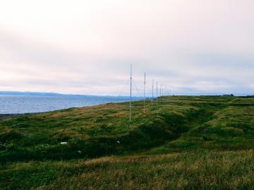
There are two sets of such HF beamforming radar systems presently operating at, respectively, Argentia and St. Brides off Placentia Bay.
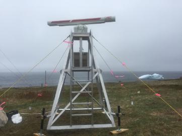
We currently have one X-band radar in-house.
Location
CSF 5102
Core Science Facility
Memorial University of Newfoundland
St. John's, NL