Certificate in Geomatics and Environment
Certificate in Geomatics and Environment
The Certificate in Geomatics and Environment is of interest to students from a broad range of backgrounds. It is a valuable complement to social, natural, and applied sciences programs such as anthropology, biology, computer sciences, earth sciences, history, economics, engineering, health and medicine, physical oceanography, environmental sciences and environmental studies.

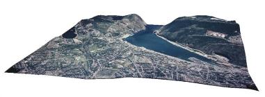
The fields of remote sensing, geographic information sciences and systems and cartography provide the most effective methods of gathering, managing, analyzing and representing geographic information. Remote sensing images provide resourceful information to observe and study cultural and physical landscapes. Examples of remote sensing applications include the monitoring of spatial changes, environmental quality evaluation, natural resource exploration, assessment and monitoring, and archaeological site assessment. Geographic information sciences and systems enable the compilation, organization, and processing of spatial (maps) and non-spatial (text statistics, graphs) data. Socio-economic, political, and environmental management decision-making is supported by the results of GIS analyses and modeling. Cartography involves the compilation, organization, and visual representation of spatial information. A variety of geographical information can effectively be communicated through cartography.
Faculty of Humanities and Social Sciences Diploma Regulations
Students intending to complete a certificate program within the Faculty of Humanities and Social Sciences must meet the admission requirements as outlined in the University Calendar. Students are also advised to consult the University Calendar regarding General Regulations for Certificate Programs and Graduation Requirements.
Advising
Throughout their program of study, students shall contact an academic advisor or the Program Director of the Certificate in Geomatics and Environment for assistance with course planning, declaring their program of study, prerequisite and registration issues, and with questions about the eligibility of any courses not listed here.
A tentative list of upcoming course offerings in the program can be found at www.mun.ca/hss/courses.php.
Declaring the Certificate in Geomatics and Environment
Students interested in a Certificate in Geomatics and Environment are first encouraged to with the Program Director to discuss the requirements of the program. After consultation with the Program Director, students wishing to enroll in the Certificate can declare a Certificate in Geomatics and Environment by contacting the Office of the Registrar. Information about declaring a program of study in the Faculty of Humanities and Social Sciences is available at www.mun.ca/hss/programs/undergraduate/ideclare.php.
Regulations for the Certificate in Geomatics and Environment
The Certificate in Geomatics and Environment consists of 21 credit hours in eligible courses as prescribed below:
- 12 credit hours in Geography 2195, Geography 3222 (or equivalent), Geography 3250, and Geography 3260.
- 6 credit hours in Geography 4261 and Geography 4203; or, 6 credit hours in one of Geography 4261 or Geography 4203 and one other approved elective course at the 4000 level as described below.
- 3 credit hours in one additional approved elective course as described below.
Eligible electives for the Certificate in Geomatics and Environment.
|
1000-level |
2000-level |
3000-level |
4000-level |
|
COMP 1001 COMP 1510 STAT 1500 |
BUSI 2400 COMP 2500 EASC 2906 STAT 2485 |
BUSI 3405 BUSI 3406 CIV 3710 COMP 3000 GEOG 3140 GEOG 3202 GEOG 3650/BIOL 3650 |
ARCH 4150/EASC 4703/GEOG 4150 ARCH 4153 BIOL 4306 BIOL 4405 BIOL 4505 BUSI 4221 BUSI 4420 EASC 4620 GEOG 4120 GEOG 4651/BIOL 4651 |
Course Prerequisites
Normal departmental prerequisites for courses are applicable.
Contact
For more information about the Certificate in Geomatics and Environment, please contact the Program Director, Dr. Benjamin Misiuk